GPS Navigation & Maps by Skobbler is another navigation based on OpenStreetMap. Application name is too general and this isn’t good for market positioning. Application works online or offline. It isn’t well known, but it has their own circle of users. I was impressed with its nice and simple user interface.
+ Nice and simple user interface.
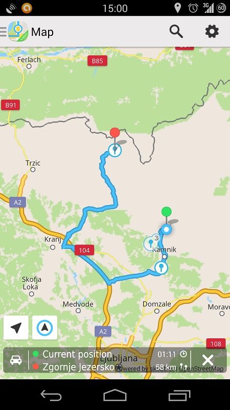
+ Fast drawing and the best OpenStreetMap application I have seen.
+ Interesting route assessment when you arrive on your destination. This will helps developers to optimize their route algorithms.
– Bad business model. After 14 days of using, you are set to make a decision: pay for continuation or use application only with maps (without navigation).
– Unusual POI searching via Foursquare.
– Car position is quite a bit late.
– Very bad time estimation. For example: for only 6 kilometers application estimates at least 24 minutes of driving.
– Bad navigation. It also looks that application don’t use unpaved roads. Roads are on the map, but it don’t use them. There is no settings for using unpaved roads. Unpaved roads are very important for me.
– If U-turn is necessary, it can take a very long to suggest it (even 2 kilometers I saw and there was some crossroads there, so it can be announced to U-turn).
– For smaller villages application display a nearby city. But in some cases it isn’t the nearest city, but some part of bigger city far away. This is strange and can be a map problem.
– Voice guidance talks to much. It is also annoying that every instruction includes a word “please”. Unnecessary.
First impression for GPS Navigation & Maps by Skobbler is very good. It looks really nice, works quicker then competition and user expects a lot. But the main point of GPS navigation is navigation itself. And here application doesn’t offer what I expected.
Rating: 4/10 (check whole ratings table)